Community Evacuation Map Posters

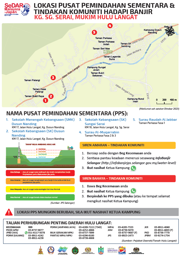
For each of the villages in the project areas of the Kapar sub-districts, A0- and A1-sized posters and A5-sized magnets showing the locations of the evacuation centres in the villages were created.  In addition, community actions to take when the flood warning and evacuation sirens activated are clearly explained.  These larger maps are put up in public places such as community halls, schools and mosques. Maps were also printed as fridge magnets as smaller and easier-to-display references.  

Poster: Evacuation Centre Location Map & Public Warning System Procedures (Kapar Sub-District, Klang)

Poster that shows residents the location of evacuation centres and public warning procedures for each of the 6 villages in Pekan Mukim Kapar.  The A0 and A1-sized posters are put up in public places such as schools and community halls.

Click to enlarge image

Poster: Evacuation Centre Location Map & Public Warning System Procedures (Hulu Langat Sub-District)

Poster that shows residents the location of evacuation centres and public warning procedures for 14 villages in Pekan Mukim Hulu Langat.  The A0 and A1-sized posters are put up in public places such as schools and community halls.

Click to enlarge image

en_USEnglish